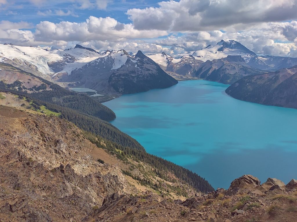
The 30km Problem: Surviving the Panorama Ridge Trail
Deconstructing the illusion of the “Instagrammable” day hike and establishing a survival framework for the Panorama Ridge Trail and the Garibaldi backcountry
Social media has a way of sanitizing the wild. If you scroll through enough aesthetic hiking blogs, the Panorama Ridge trail looks like a casual stroll to a turquoise viewpoint—a backdrop for a photo-op rather than a high-consequence alpine objective. For a Panorama Ridge hike, we reject this narrative. We operate under a Survival Framework that prioritizes physiological reality over filtered imagery.
The “30km Problem” is the fundamental challenge of a Panorama Ridge hike. It is a mathematical and physical gauntlet that punishes the unprepared.
The Brutal Arithmetic of the Panorama Ridge Trail
Most hikers measure difficulty by distance alone. They see 30 kilometers and think of a long walk. They fail to factor in the 1,600 meters of vertical gain. This is not a flat trail; it is an endurance event that requires the metabolic output of a marathon, performed on uneven, technical terrain.
By the time you reach the final ascent, your glycogen stores are likely depleted, your stabilizer muscles are fatigued, and your decision-making capacity is diminished. This is where “aesthetic” hiking ends and survival begins.
| Metric | Reality | Consequence |
|---|---|---|
| Total Distance | 30km (Round Trip) | High probability of late-night finishes in the dark. |
| Elevation Gain | 1,600m | Severe cardiovascular strain and rapid lactic acid buildup. |
| Time Estimate | 10 – 12 Hours | Requires strict pacing and significant caloric intake. |
The Alpine Reality: Isolation and Atmosphere
The most dangerous myth propagated by casual blogs is that help is just a phone call away.
- Zero Cellular Service: From the moment you leave the lower meadows, you are off the grid. If an injury occurs, you cannot call for a rescue. You are dependent on your own gear and the preparedness of your group.
- Severe Temperature Swings: The valley floor may be a balmy 25°C, but the ridge is an exposed alpine environment. Temperatures can plummet to near freezing within minutes when a cloud layer rolls in or the sun dips behind the peaks. Wind chill on the summit often leads to rapid-onset hypothermia for hikers wearing nothing but “aesthetic” athletic gear.
The Scree Scramble: The Final 400 Meters
The final push to the summit is not a trail; it is a treacherous scramble through loose, shifting volcanic scree. For the uninitiated, this is where panic sets in. Every two steps forward often result in one slide backward.
The physical toll of the first 12 kilometers of climbing culminates here. One misplaced foot on the ridge can lead to a significant fall. It is a technical section that demands focus at exactly the moment when your brain is most clouded by exhaustion.
Always check the official BC Parks Garibaldi alerts before your departure.
The Panorama Ridge Trail Survival Framework
Route Logistics
Breaking down the 30km into tactical phases. Pacing strategies for the Rubble Creek switchbacks, managing the Taylor Meadows junction, and navigating the final scree ascent.
Mandatory Gear
Pushing back against generic packing lists. The exact rigid-soled footwear, thermal layering systems, and redundant navigation tech required to survive.
Emergency & Evacuation
Hard turnaround times, no-signal injury protocols, and weather hazard identification to ensure you do not become a search and rescue statistic.
The Digital Basecamp
The ultimate high-resolution, offline-ready navigation suite. GPX files, critical waypoints, and pacing calculators designed specifically for the Panorama Ridge Survival Framework.
Master the Ridge
Panorama Ridge does not care about your photos. It only cares about your preparation. We have spent hundreds of hours mapping the nuances of this terrain to ensure you don’t become another statistic in the Garibaldi search and rescue logs.
Do not leave your safety to chance or generic blog advice. Secure your digital safety net today.
COMING SOON: Download the Digital Basecamp Map Package
The ultimate high-resolution, offline-ready navigation suite designed specifically for the Panorama Ridge Survival Framework.
Panorama Ridge Digital Basecamp Package: Coming Soon!